Daily Archives: October 4, 2011
Slickrock 100 Prep
For the race report, click here.
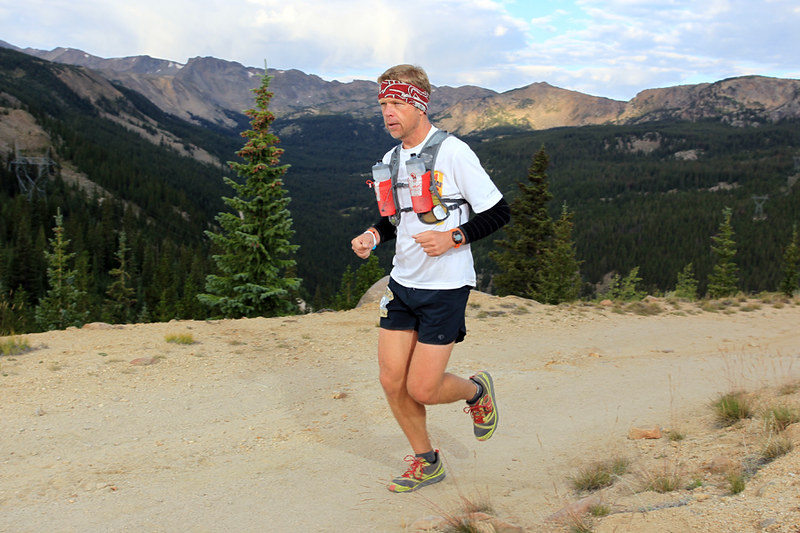
Went for an easy 5 miler today, that will probably the last run of any significance I do before race day. Legs were bleh. Typical for race week. I’d say I’m at about 85%. Still working my way through the cold that hammered me last week. Feeling a lot better, but my resting heart rate is still 10 beats high and I don’t feel as good as I used to on my runs. It is what it is.
I’m really looking forward to running the Slickrock 100. I am nervous about it being a first year event, though. With some fairly inexperienced (though very passionate) RD’s. Sherpa John posted a good interview with the RD about a week ago. I hope they, and we, are not biting off more than we can chew. The course marking is my main concern. While it is going to be awesome to run a 100 mile loop, or as I prefer to think of it – a point to point where you just happen to end up back at your car, the task of marking and maintaining those markings is massive! I’m very familiar with the Moab area, having made dozens of trips over the years, and the race course is smack in the middle of a huge spiderweb network of roads and trails.
Take a gander at this to get an idea of what I’m talking about…

And that’s just a 1-2 mile section of what we’ll be traveling through. At night.
The race maps leave a lot to be desired as well. Very hard to discern the exact path we will be taking. It’s all good. I generally am not high maintenance and don’t have a lot of expectations. I know the site, maps, and race will evolve as the years go on and things will shape up. I’m very happy to be able to take part in the first of hopefully many Slickrock 100s.
This 100 miler wasn’t originally on my schedule this year, but I have been wanting to do another one after a pretty dismal showing at Leadville. I bounced back quickly from that one and have put in my best September’s worth of training since I began running. By far. I got in 280 miles which is a long way off my best month, but huge for me post-Leadville. I’m able to make the trip thanks to my wife allowing me to go play for yet another weekend, and cashing in my 42nd birthday present chips.
In an effort to be as prepared and self-sufficient as I possibly can, I’ve spent the last few days squinting at satellite images of the course and trying to reconcile that with the maps on the race website. I think I have come pretty close to figuring out the entire route, with a few small exceptions. I dropped several markers onto a Google map and came up with this (click to get the interactive version):
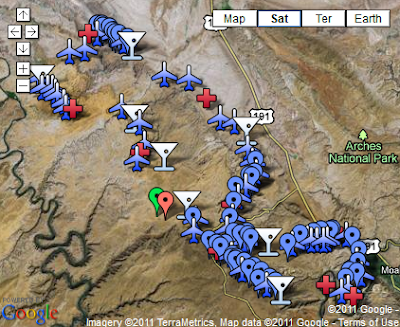
The martini glasses (needed an easily recognizable icon) represent the water-only aid stations, red crosses are full aid stations, and the airplanes are confidence markers placed at key junctions, etc. The other blue markers are there to flesh out the route on the map, but are not ones I am planning on using as waypoints.
Now the fun part.
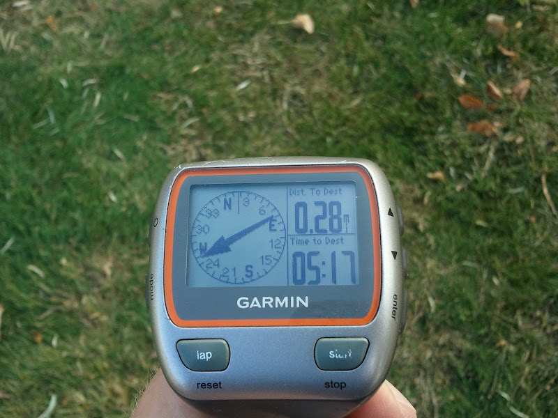
I had to convert everything from decimal lat/long into degrees/minutes/seconds and then put that in the notes section of each marker. I’m running the race with a Garmin 310XT and will have 50 waypoints loaded up to use if needed.
It is a HUGE pain in the butt to do this, as there is no way to transfer them to the watch from the computer. They have to be entered manually one at a time on the device itself.
I’m not planning on running with my head down staring at the watch the whole time, but it seems like people are always going off course in even the biggest of events. I may take longer to finish than I would like, and my time goals may not be met, but I’m determined not to have time spent wandering around the desert looking for a flag be the reason for that.
Here is a link to a Google doc I created with all of the coordinates I plan on using:
Doc
The idea is to be able to rapidly pull up the next closest point of interest in case there is ever any doubt or question. I’ll be able to get a quick bearing and be on my way.
I may not use this feature at all during the race. That would be optimal, in fact. I won’t feel like it has been a wasted effort even if at the pre-race meeting they were to announce that the course has been radically changed. Examining the area in detail has allowed me to mentally fit the pieces and places I know into the ones that I was unfamiliar with. I now have a much better idea of how things are layed out in general, regardless of what specifics may change.
I love what I have seen of the course. Jeep and 4×4 roads, canyons, slickrock – terrain that I absolutely love to run around in. I can’t wait. I’m looking forward to the night section up on Poison Spider Mesa where we are set to have a huge full moon and a brilliant desert sky. I was once able to ride the Slickrock bike loop with no lights because the moon was so bright. Good times!
Best of luck to everyone in the race. It’s looking like it will be a great weekend!
Disclaimer:
This was a total seat-of-the pants effort. I do not have any insight into the official route. These coordinates were generated as a result of eyeballing maps and satellite imagery. No guarantees whatsoever that any of this will match anything in the real world on race day!