Category Archives: stuff
2013 14er Trip – Day One
Due to a shorter than normal vacation in early July, I ended up with the opportunity to take three days off work later in the month and head up to the high country. My son and I quickly threw some plans together and decided to keep home base in Leadville and venture out to some different peaks each day. This meant 4:45 wakeups each morning to get to the trailhead and hopefully beat the storms which usually show up later in the day.
On the way up after work on Tuesday I set the Copper to Leadville knee-driving FKT (the burrito needed two hands). If there ever is a knee-driving world championship, I’m in. #medalcontender

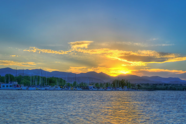
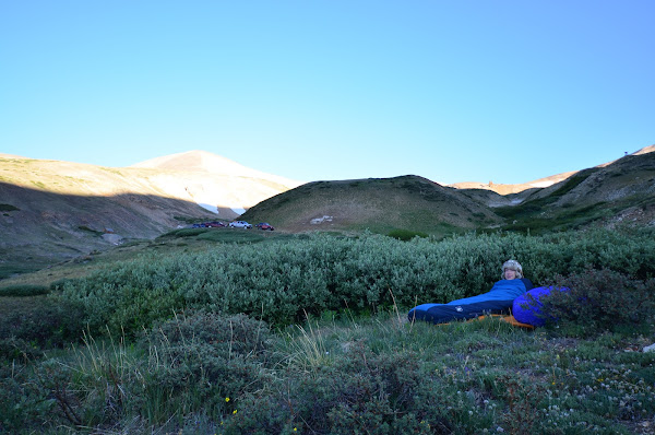
We spent the first evening high above town looking to capture the sun setting over Turquoise Lake. The sunset didn’t pan out, but I happened to catch some great Crepuscular Rays with one of the beams shining directly on the city.

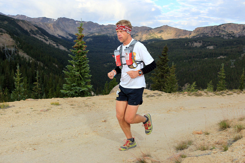
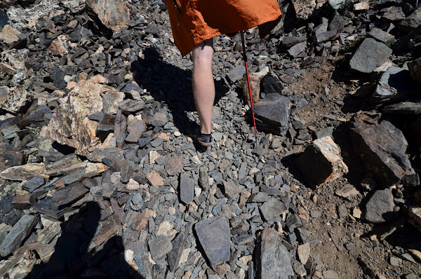
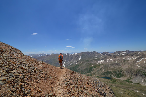
Day one objective was Mt. of the Holy Cross. We would be taking the Halo Ridge route, which is a much longer (at least time-wise) approach to the summit. It traverses 2.5 miles of the ridge and without any trail. Almost all boulder-hopping.
The climb up Notch Mountain looked bad on the map, but turned out to be very nice with many switchbacks and a good trail. We paused for a bit to watch pika, marmots, and the camoflaged ptarmigans.


The columbine were in their full glory. This particular variation (there are over 70) is the Colorado state flower. Blue for the sky, white represents snow, and yellow represents gold mining.

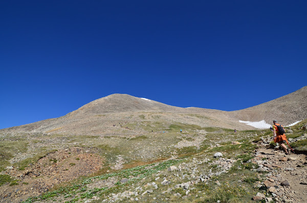
Our first view of Holy Cross (named for the gullies that make a cross shape, especially evident when filled with snow) was magnificent. From this spot we could see the entire route to the summit. Kind of hard to tell in this shot, but the peak is actually over a mile away and 1,000′ higher than our location.

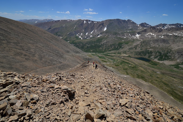
The scale of the entire area was amazing. I let Malcolm get a few minutes ahead of me and he turned into a tiny yellow spec on the ridge.

Even helicopters look microscopic from up here.

I snapped this panorama before I took off to catch up. The lake is called the Bowl of Tears. I probably shed a few later in the hike…

Hop. Hop. Hop. Long way from help. Don’t break an ankle…


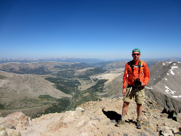
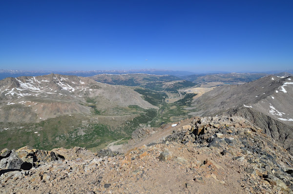
We finally reached the summit after spending nearly 4 hours (stops and photos included) to travel the 2.5 miles along the ridge.


Thankfully the sketchy-looking clouds that began showing up at 8:30 never really amounted to anything. The descent was no picnic, but at least we were on a trail now.

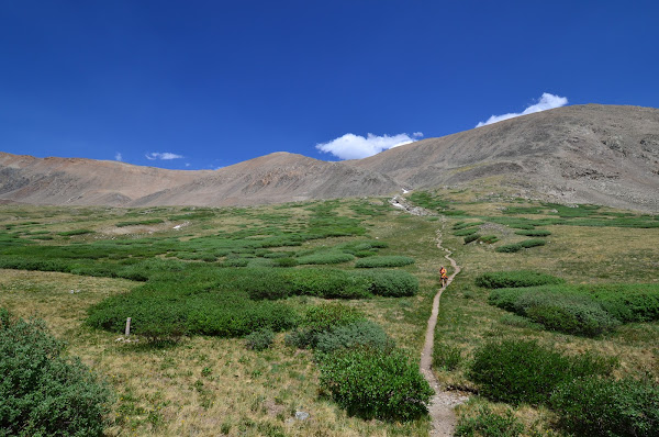
It was great to get back to some vegetation after being on the rocks so long.

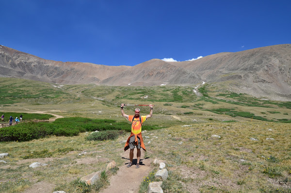
Normally with 14ers, once you summit it’s all downhill back the car. Holy Cross has a nasty little surprise with the 1,000′ climb over Half Moon Pass standing in your way. Malcolm absolutely crushed this climb and I barely held on. We were so glad to get to the top! After receiving some feedback from the home front that we were looking too serious in our summit photo, we risked cracking our faces and smiled for this one.

The trail back to the parking lot was a little slice of heaven.

SherDeCaLiBro
Our plans for this weekend changed nearly a thousand times it seemed, finally settling on doing a loop around Abyss Lake and linking up the Bierstadt and Evans summits with a trip over the sawtooth. A shortened version of the route I took a few years ago:

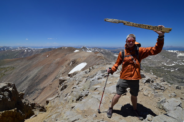
The weather was in our favor, with a stout high pressure firmly blocking out any moisture in the area. This meant we wouldn’t have to deal with the threat of thunderstorms while up on the exposed ridges. Realizing that we had a somewhat rare situation on our hands with a free Saturday lining up with such a great weather pattern nudged us to change plans yet again. We’d drive down and camp near the trailhead for the DeCaLiBron and do the loop the next morning which would take us over the 14er summits of Democrat, Cameron, Lincoln, and Bross. That would make four out of the five 14ers that are located in the Mosquito Range of central Colorado.
Then the plan changed again.
As we were carrying the last load out to the car, Malcolm casually mentioned that we might as well just do Sherman tonight (the remaining Mosquito Range 14er). Since it was in the same neighborhood and all. Okay, then. Now that sounds like a plan!
We left home around 7:00pm Friday night, but due to stops to grab some sunset shots, dinner, and supplies for the next day, we didn’t truly hit the road until 9:00.
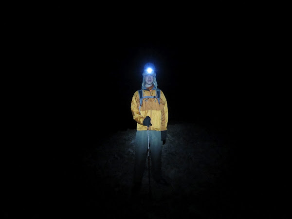
We found our way to the Mt. Sherman trailhead in the dark, and started hiking at 11:20. It was a pleasant night with a quarter moon that set early, leaving an inky black sky with thousands of twinkling stars.
The first half of the hike was a straightforward march up a dirt road that traveled past some abandoned mines. One of them produced over 300 TONS of silver back in the 1970’s.
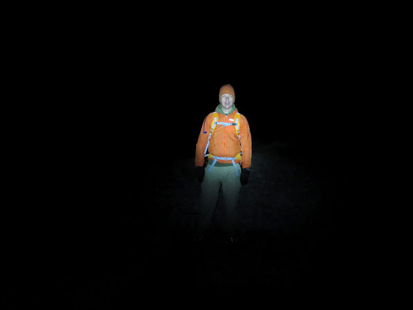
We scrambled up and over a small cornice to gain the prominent saddle at a little over 13,000′. Now it was well past midnight and time to work a little harder to get up the steep ridge. At 13,600′ the ridge narrows quite a bit and you come to a little notch (sort of a mini-saddle). This is where things got interesting. The wind, which had been steady all night, was absolutely raging through here. We regrouped at the final spot of shelter and then I ventured out, only to turn back after about 10 steps. It was wild! I took off my pack, broke down my trekking poles, secured them, and then cinched everything up tightly. I was going to need my hands free and would be in a crouched position, making the poles more of a hinderance than help.
We carefully navigated through the notch and then began climbing the ridge again. Once we got a little ways above the notch, everything calmed down. Soon we were on the summit with only a minor breeze to contend with. We took some pictures and then shut off our lamps to gawk at the amazing sky for a while. Quite a sight.
1:10 AM
The descent started out nice and mellow, but we soon encountered the wind far higher up on the ridge than where we had left it behind on the ascent. It was crazy, and felt like it had at least doubled intensity. I’m thinking 60+ mph would be a reasonable estimate. We were doing forward and reverse crab-like walks at some points to keep low and still make progress. I became aware that I was actually piloting my foot with each step, adjusting pitch, yaw, and roll to guide it to the landing spot. You just couldn’t force your foot into position.
After what seemed like a very long time we finally dropped below the ridge and were out of the deafening roar.
The rest of the hike was mellow and we just stared into the spots our headlamps made on the ground and trudged onward. Made it back to the car at 3:00 in the morning, dumped our sleeping bags on the ground, and set the alarm for 6:45.
The alarm wasn’t needed… I barely dozed at all, and was feeling like I was about 105 years old when I got up.
It took longer than I expected to get to the trailhead of our next objective, the DeCaLiBron. The late-ish start wasn’t too bad, given that we had excellent weather conditions. Four summits were on the menu, and we made short work of Mt. Democrat and spent a while on the summit enjoying the great view.
Cameron was up next, and Malcolm worked me over pretty good on this one as his gummi bears started to kick in and give a boost of energy. I was working hard to keep up! Must have been the hiking pole-leg.
You can see the smoke from the Treasure Fire near Leadville that started about 30 minutes before this picture was taken. We didn’t notice it at the time.
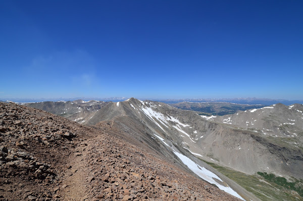
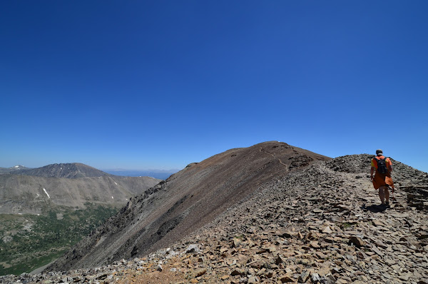
The Cameron summit was somewhat plain, so we didn’t take much of a break there. Lincoln was much more interesting.
As we were coming off the Lincoln summit, a girl stopped me and pointed out a mountain goat that was working its way toward us. It was very casual and not in any hurry. In a matter of about a minute, there were at least 6 of us lined up next to each other snapping photos like crazy. The goat kept moving closer, and closer. It seemed to be more curious than afraid. When it got about 10 feet away, it looked a little more determined and kept moving towards us. I was in sort of a football lineman position with one hand on the ground and holding the camera low with the other while I maintained eye contact and fired off shots without the help of looking through the viewfinder. Closer and closer it came until I finally stood up straight when it was 4-5 feet away. This stopped its approach and it backed up a bit. The funny thing was, I had forgotten about all the other people. It turns out they were all in a single file line behind me! It looked like something out of a cartoon with each person’s head poking out at a different angle.

The day started to drag on a little after that, and we made quick work of Bross before the final descent. That descent went on forever! On and on and on we marched down the mountain.
About halfway down, I finally noticed the smoke as it was creating a pyrocumulus. This shot ended up as my Friday Foto for the week.

A final push and we were done.
We definitely made the most of the time we had available.
Springer Fire
As my wife was driving home Sunday afternoon, she spotted what appeared to be smoke behind a ridge near our house. It was a very hot day, and there were scattered summer-time clouds around, so it was hard to tell if it was really smoke or just a low-lying cloud. She called 911 to report it, and was told that there hadn’t been any other calls about it.

Malcolm and I loaded up the camera, binoculars, and made a quick stop for fuel before going to check it out. Once we got far enough away from the mountains to see it well, we couldn’t decide for sure whether it was smoke or a cloud. We headed back into the mountains to get a closer look.

We headed in the direction of Indian Creek and Rampart Range Road thinking we’d get a good look at it from there. No dice, so we continued down to the South Platte and towards Deckers. Still couldn’t get a good read on what was going on.

We pressed onward thinking it would be just a couple miles south of Deckers. Nope.
After a while we were traveling through the burned out area from the Hayman Fire in 2002 (Colorado’s largest recorded fire @ 138,000 acres).

We could at least tell that it was smoke now, but didn’t seem to be getting any closer. It was like chasing the end of a rainbow.

We made a stop in Woodland Park to grab some food and pull up a map to see what our options were. We headed west.

It looked like an entire mountain was being consumed.
We got to the closest access point just as the media people were getting set up after over 90 minutes of drive time. My wife had spotted and called on a fire that was over 50 miles and 3 counties away as the crow flies!
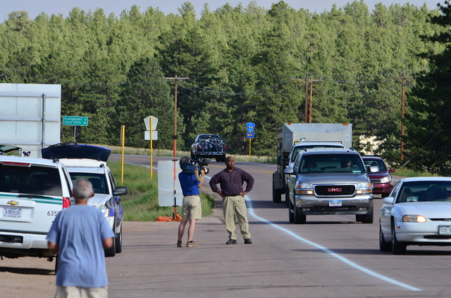
Soon after that, the first of the bucket-toting heli’s made an appearance.


For a minute, I thought these pelicans might scoop up some water and help out, too.

Several homes and cabins were being threatened.

At one point, a slurry bomber banked hard and headed right for us. I wondered if it would dump its load where we were standing. Malcolm said, “Prepare to be retarded.” The surroundings were grim, but I gotta say that cracked me up.

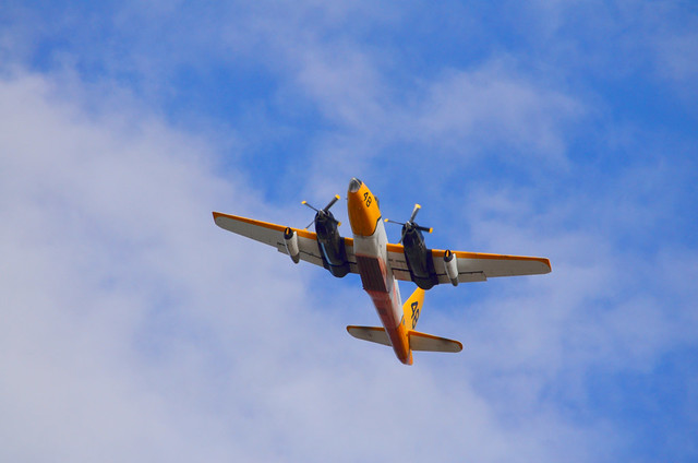
We watched for a couple of hours while a total of 4 heavy tankers, a few single-engine tankers, and 3 helicopters did their best to contain the blaze.


While it was sad to see the forest burning, it was neat to have a front-row view of the firefighting operations.